Geophysics Field School: Earthly Interactions
Wavelets in January GSH Journal
By Azie Aziz, Robert Stewart, and Li Chang
 By tradition, the great teacher Confucius said, “I hear and I forget. I see and I
remember. I do and I understand.” How apt, even some 2,500 years later. In our world
of geoscience education, the quotation reminds us of how important it is to put into
practice what’s been taught in the classroom. Books, the internet, and lecture hall
instruction are all critical in learning. But, we don’t fully appreciate the concepts
of geologic scale, wavefield sampling, data generation, measurement error, and a host
of other key factors until in the field working with actual instruments.
Our professional societies and many members of the industry recognize the need for field experience in new geophysicists, as well as the expense in providing it. We are thus, most appreciative to the SEG Foundation and TGS for their support of our field program.

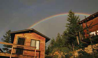
Figure 1: Cabins and rainbow at the YBRA Field Camp, Montana.An essential part of the undergraduate geophysics program at the University of Houston
(UH) is the Geophysics Field Camp. For the last five summers, the UH has hosted a
field program at the memorable Yellowstone Bighorn Research Association (YBRA) camp
near Red Lodge, a quaint town southwest of Billings, Montana. The field facility has
a library, cabins (sleeping a total of 100 campers and instructors – Figure 1), and dining hall – all in the spectacular setting of the Beartooth Mountain Range.

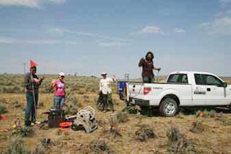
Figure 2: Seismic crew at the Elk Basin oilfield, Montana.In August 2013, five faculty from UH and UT-Austin, along with technical staff and
assistants from the Allied Geophysical Lab, joined 33 students for the Camp. Acquisition
techniques ranged from the 3D reflection seismic method through S-wave refraction
seismic, total station and GPS surveying, VSP, well logging, gravity and magnetic
measurement, ground-penetrating radar (GPR), and Lidar. Our targets included hydrocarbons
in the Elk Basin oilfield (Figure 2), complex tear faults on Mt. Maurice, numerous glacial deposits, and coal mine workings.
The daily schedule was intensive - participants start with breakfast at 7:00 am, undertake surveys for the full day, and finish in the late evening with a presentation of their days’ data. Occasional fatigue was usually overcome the next day by a new technique, scenic landscape, and enthusiastic fellow students and instructors. Friday night at the Bear Creek Saloon pig races and a free Saturday white water rafting also helped to re-invigorate.
Students are divided into four working groups and remain with that group for the first half of the Camp. Each group has a unique geophysical survey per day. Then everyone is mixed into new groups for the second half of the Camp to provide further team experience. Skills related to professional field practice - safety, note-taking and photography, radio communication, and leadership (plus mutual patience) – are emphasized.

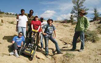
Figure 3: Ground-penetrating radar (GPR) team at a dinosaur excavation site.Manual activities like planting and orienting three-component geophones, pushing the
GPR cart (Figure 3), and untangling refraction cables are accomplished along with field calculations
of dominant frequencies, various velocities, and event identification.
Field camp provides an opportunity for students to learn a wide variety of geophysical and interpersonal skills. Most students come to the Camp with little or no field experience. After the ten days, some have discovered their true passion for working outdoors, designing surveys, operating complex and precise instruments, working in a team for a common goal, and acquiring physical data. This enhances students’ abilities and broadens their horizons in pursuing a future in exploration geophysics. Many of their careers will ultimately be centered at the office or lab, but there will always be an appreciation for the beauty and rigors of real field work. And how much effort went into getting that data on the computer screen!
NOTE: This article first appeared in the January 2014 issue of the Geophysical Society of Houston’s GSH Journal. Republished with permission from GSH.