
Urban Geology
Urban Geology
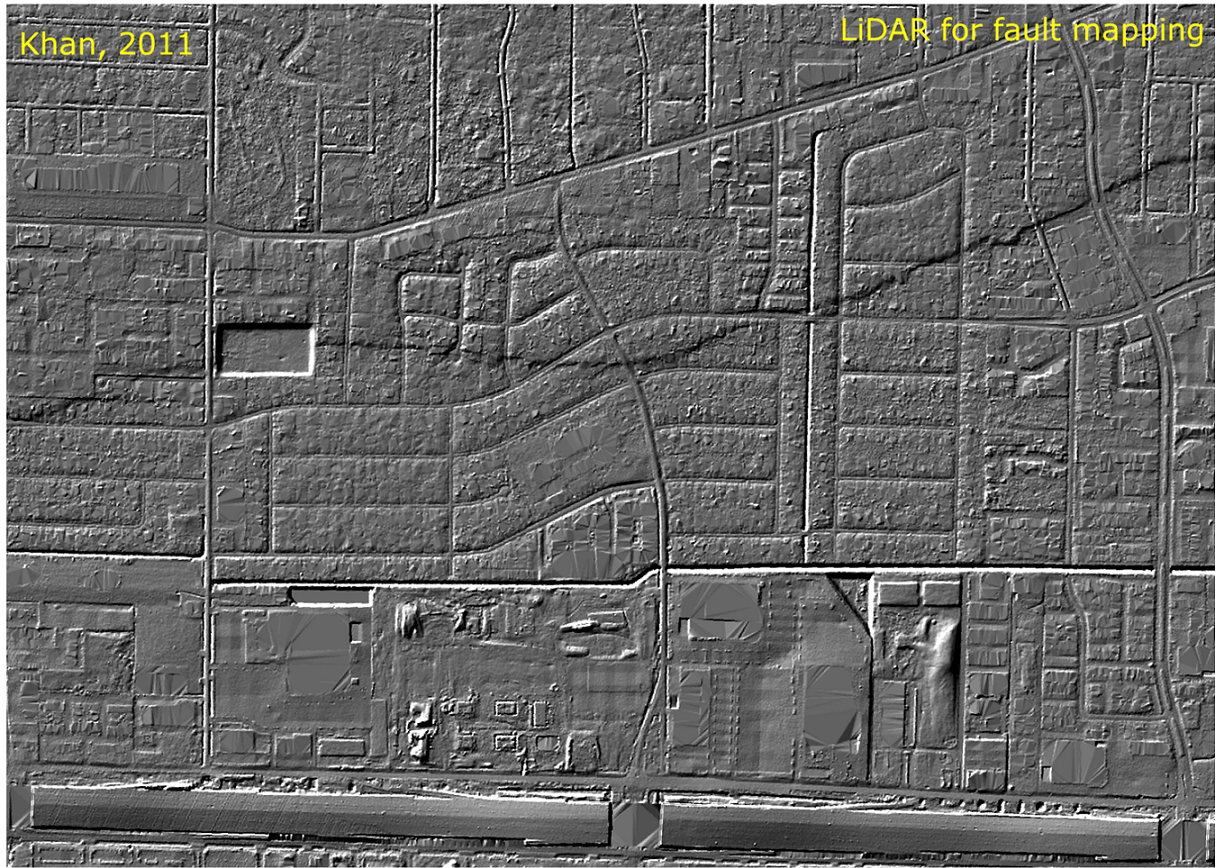
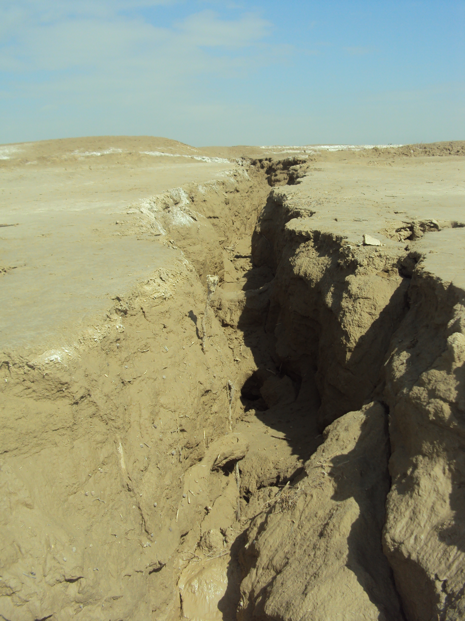
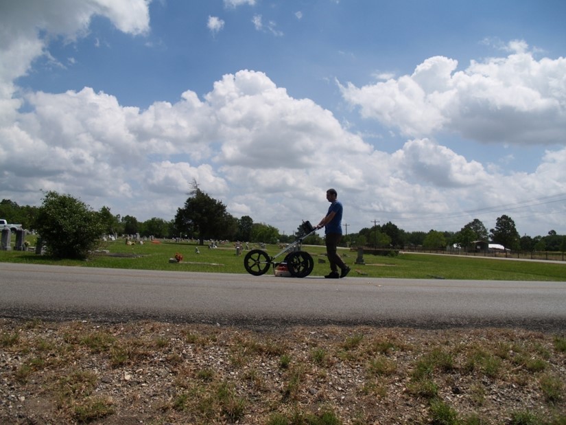
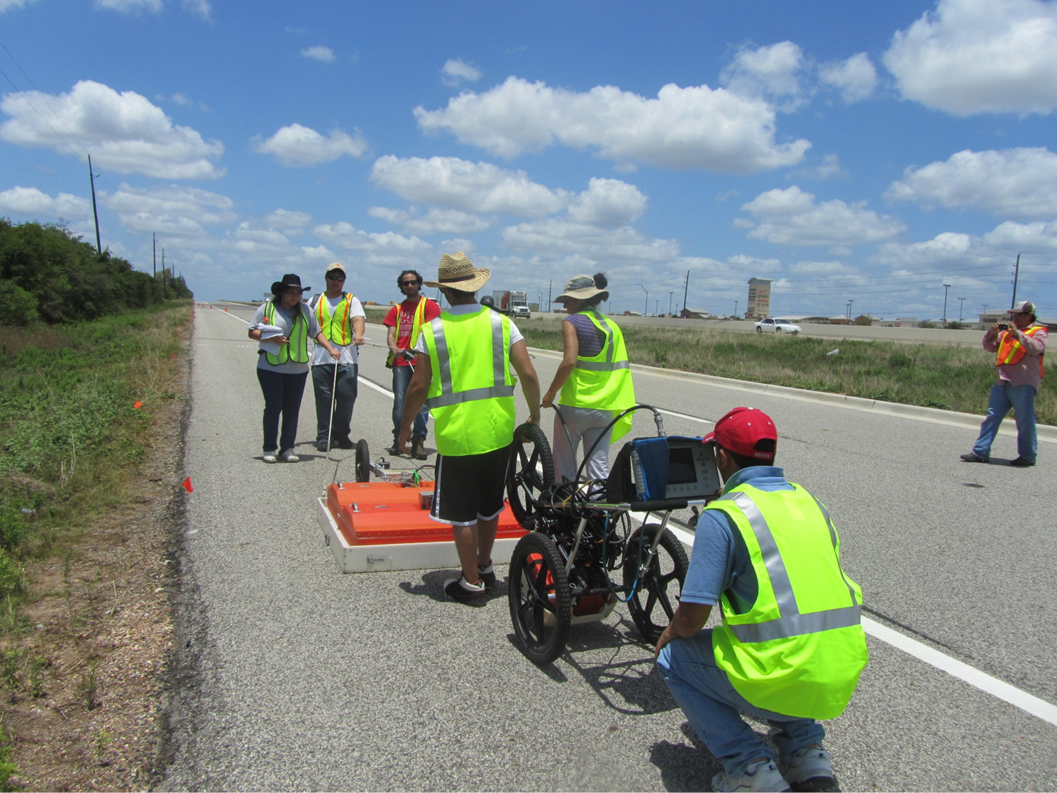
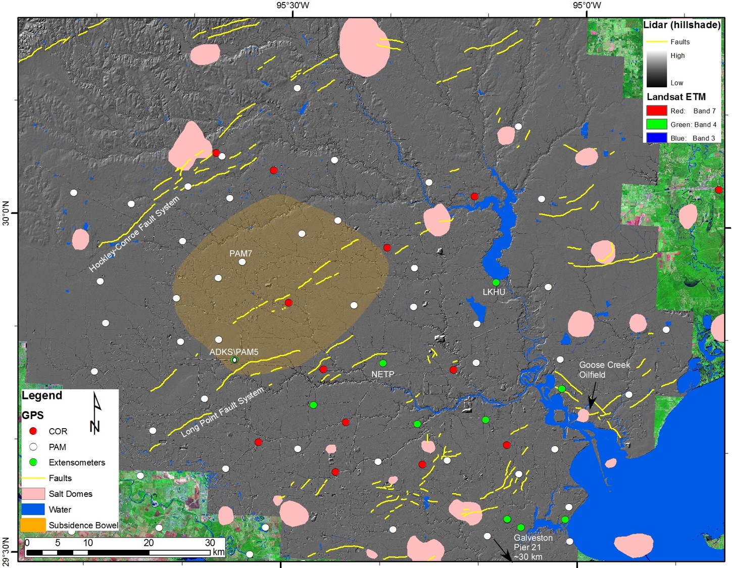
We are using innovative remote sensing (Lidar, TLS) and geodetic (GPS, InSAR, and radar altimetry) techniques to monitor fault activities, subsidence, and coastal erosion in the Northern Gulf of Mexico and other parts of the world. Using Lidar, we have mapped hundreds of faults in Houston and surrounding areas. Using ground-penetrating radar (GPR), shallow seismic, and gravity data we are imaging major faults in the subsurface to understand the driving mechanism for surface deformation in this region. Groundwater withdrawal is attributed to be the main cause of subsidence in the Houston area. Our observations suggest the contribution of salt diapirism in the subsurface and to the surface deformation in southeast Texas.
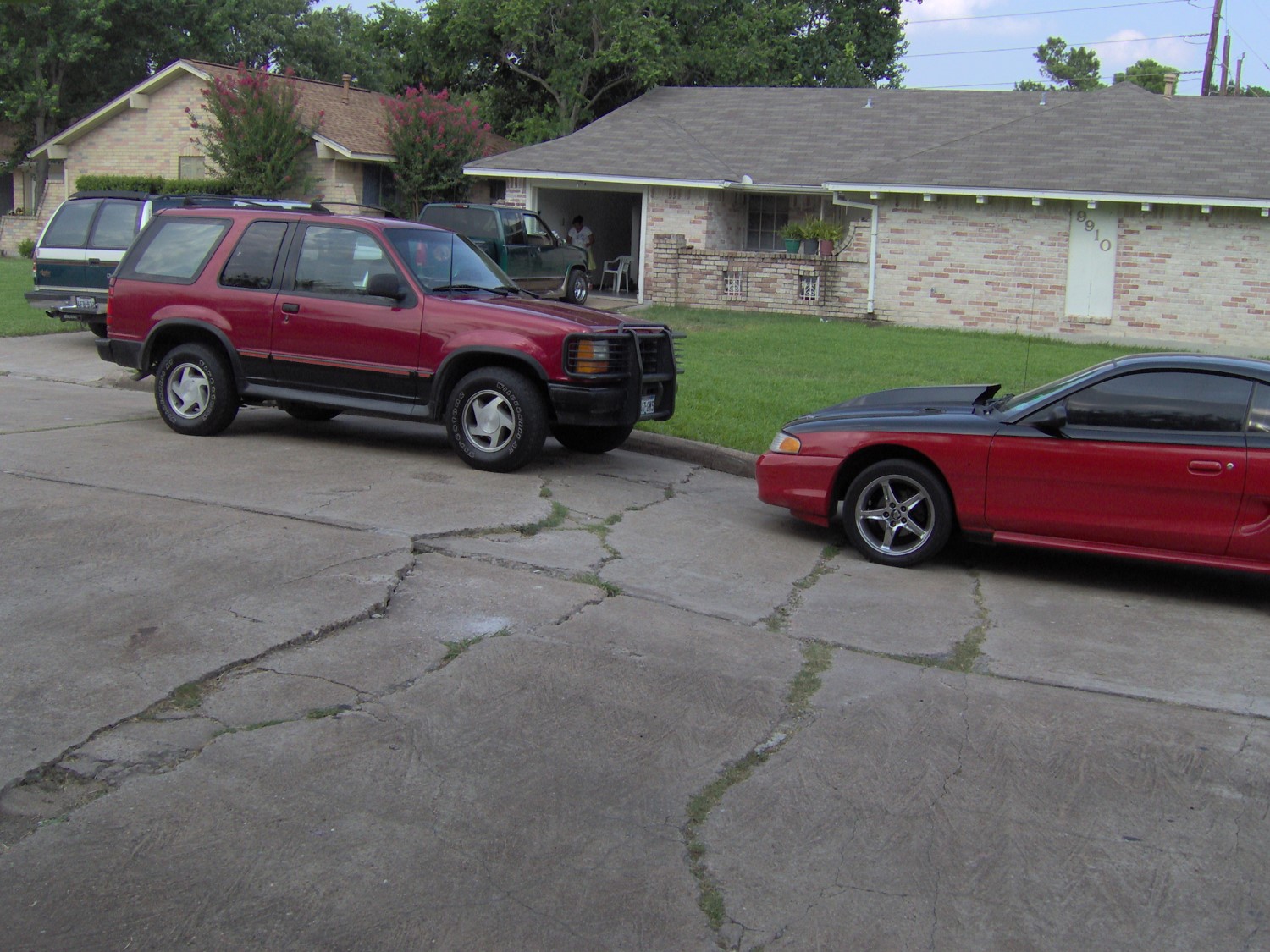
Photographs
Publications
Huang, J., Khan, S. D., Ghulam, A., Crupa W., Abir, I. A., and others. 2016.Study of Subsidence and Earthquake Swarms in Western Pakistan. Remote Sensing, 8, 956; https://doi.org/10.3390/rs8110956
Khan, S. D., Huang, Z., Karacay, A., 2014. Study of ground subsidence in northwest Harris county using GPS, LiDAR, and InSAR techniques. Natural Hazards, 73:1143-1173 https://doi.org/10.1007/s11069-014-1067-x
Khan, S. D., Stewart, R. R., Otoum, M., Chang, L., 2013. A geophysical investigation of the active Hockley Fault System near Houston, Texas. Geophysics, 78(4), B177-B185. https://doi.org/10.1190/geo2012-0258.1
Engelkemeir, R., Khan, S. D., Burke, K., 2010. Surface Deformation in Houston, Texas using GPS. Tectonophysics, 490(1-2), 47-54. https://doi.org/10.1016/j.tecto.2010.04.016
Engelkemeir R., and Khan, S. D., 2008. LiDAR Mapping of Faults in Houston, Texas, USA. Geosphere, 4(1), 170-182. https://doi.org/10.1130/GES00096.1