
Hyperspectral Imaging
Hyperspectral Remote Sensing
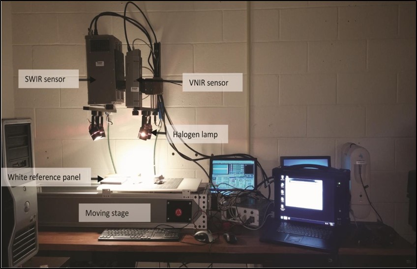
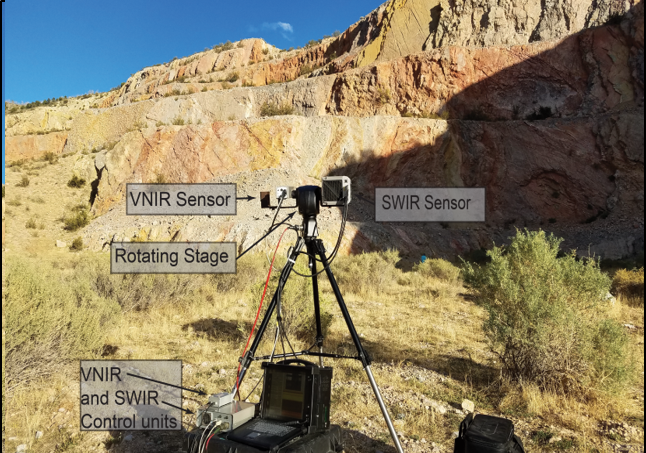
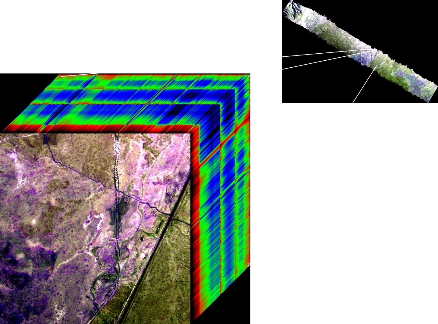
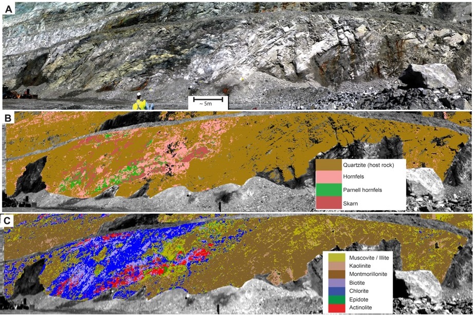
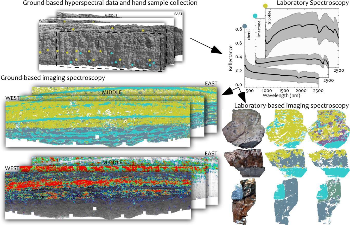
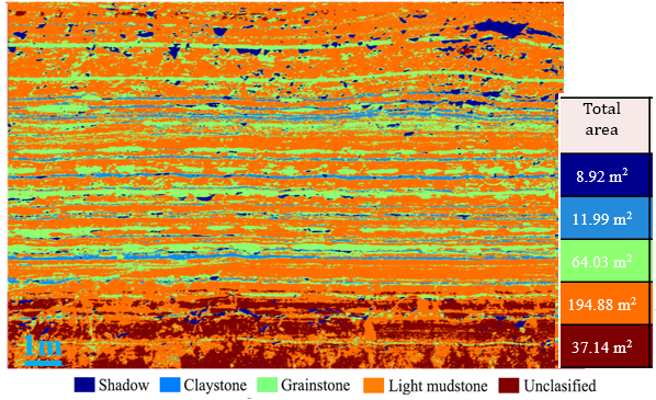
Hyperspectral remote sensing data contains hundreds of bands in a continuous electromagnetic spectrum collected from visible light to short-wave infrared range and holds the potential to characterize rocks with great precision. We are integrating spectroscopy, hyperspectral remote sensing, and geochemistry data for diverse applications ranging from mapping rock alterations, imaging rare-earth, and other economic mineral deposits.
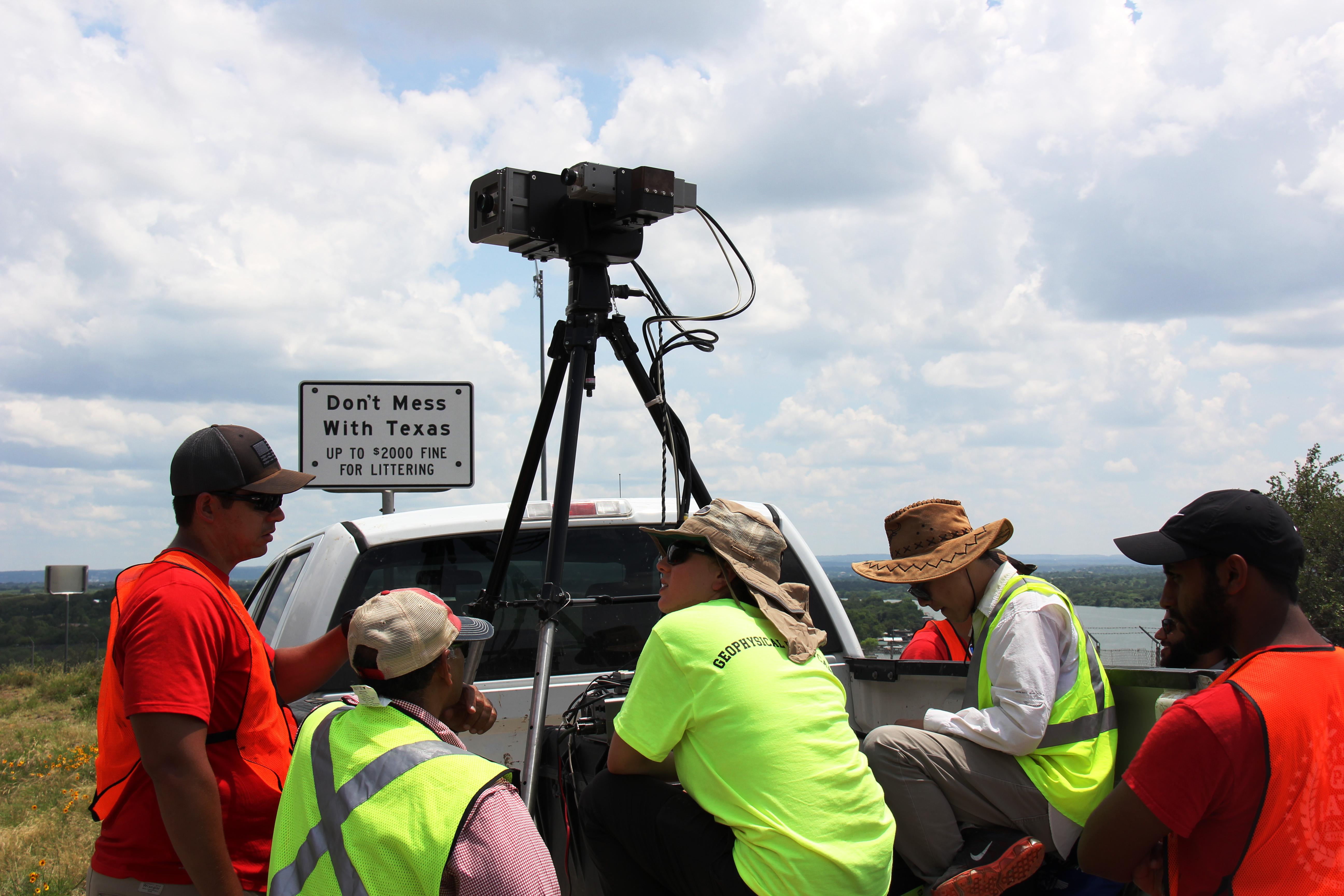
Photographs
Publications
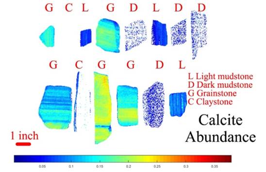
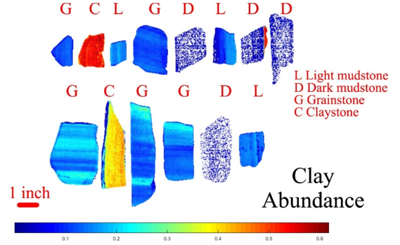
Shahtakhtinskiy, A., Khan, S. D., 2020. Quantitative analysis of facies variation using ground-based lidar and hyperspectral imaging in Mississippian limestone outcrop near Jane, Missouri, Interpretation, 8(2), 1–14 https://doi.org/10.1190/INT-2019-0151.1
Krupnik, D., Khan S. D., 2019. Close-range, ground-based hyperspectral imaging for mining applications at various scales: Review and case studies. Earth-Science Reviews, 198, 102952. https://doi.org/10.1016/j.earscirev.2019.102952
Sun, L., Khan, S. D., Shabestari, P., 2019 Integrated Hyperspectral and Geochemical Study of Sediment-Hosted Disseminated Gold at the Goldstrike District, Utah. Remote Sensing, 11, 1987. https://doi.org/10.3390/rs11171987
Alonso de Linaje, V., Khan, S. D., Bhattacharya, J., 2018. Study of carbonate concretions using imaging spectroscopy in the Frontier Formation, Wyoming, International Journal of Applied Earth Observation and Geoinformation, 66, 82-92; https://doi.org/10.1016/j.jag.2017.11.010
Okyay, U., Khan, S. D., 2018. Spatial Co-Registration and Spectral Concatenation of Panoramic Ground-Based Hyperspectral Images. Photogrammetric Engineering & Remote Sensing, 84 (12), 781-790. https://doi.org/10.14358/PERS.84.12.781
Okyay, U., & Khan, S. D., 2016. Remote detection of fluid-related diagenetic mineralogical variations in the Wingate Sandstone at different spatial and spectral resolutions. International Journal of Applied Observation and Geoinformation, 44, 70-87. https://doi.org/10.1016/j.jag.2015.08.001