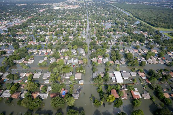
Studies Assess Impacts of Harvey and Subsequent Flooding in Southeast Texas
Three groups of Department of Earth and Atmospheric Sciences faculty and graduate students are involved in scientific studies of the geologic and meteorological impacts of Hurricane Harvey and its flooding on different areas of southeast Texas.
 In August 2017, Drs. Will Sager and Julia Wellner and EAS graduate students completed
two surveys of the Galveston Bay tidal inlets. One survey imaged the underwater flood
tide delta north of San Luis Pass using a chirp sonar subbottom profiler. The other
collected side-scan sonar, multibeam bathymetry, and chirp sonar data Bolivar Roads
to learn about sediment movement and bedforms in this high current environment. They
are submitting a RAPID proposal to do follow-up surveys to document the storm effects
on deposition and erosion of sediments and bay bottom bedforms (e.g., sand waves)
in Galveston Bay. A previous EAS news article described some of the work completed
prior to Harvey: www.uh.edu/nsm/earth-atmospheric/news-events/stories/2017/0823-tidal-delta.php.
In August 2017, Drs. Will Sager and Julia Wellner and EAS graduate students completed
two surveys of the Galveston Bay tidal inlets. One survey imaged the underwater flood
tide delta north of San Luis Pass using a chirp sonar subbottom profiler. The other
collected side-scan sonar, multibeam bathymetry, and chirp sonar data Bolivar Roads
to learn about sediment movement and bedforms in this high current environment. They
are submitting a RAPID proposal to do follow-up surveys to document the storm effects
on deposition and erosion of sediments and bay bottom bedforms (e.g., sand waves)
in Galveston Bay. A previous EAS news article described some of the work completed
prior to Harvey: www.uh.edu/nsm/earth-atmospheric/news-events/stories/2017/0823-tidal-delta.php.
Dr. Bob Wang and EAS graduate students have conducted LIDAR mapping of the sand dunes adjacent to the mouth of the Brazos River. Wang is applying for funding to resurvey the dune area to assess the impact of the storm’s surge and wave action.
Drs. Bob Talbot and Yuxuan Wang of the EAS Atmospheric Sciences Group are applying for research funding to examine how Harvey affected methane emissions from the flooded areas of Houston and surrounding areas. Talbot is also preparing a feature article for the Bulletin of the American Meteorological Society on the impact of Harvey in collaboration with Houston’s Channel 13 (KTRK) meteorological team.