[Click on the blank on the left and enter a value. Hit the tab key and enter the other value. Click on the operation that you want to preform.]
Use the calculator above to fill in the blanks in the Shoreline Changes Table for the Stations that follows.
Look at the table and decide what operation you need to perform to fill in the blank. Position your cursor in the answer box and type in your answer. Push the return key on your keyboard to have your answer evaluated.
| Station | Distance (feet) | Rate (feet per year) |
|---|---|---|
| 10 : 1852-1974 : (122 years) | + 550 feet | - 4.5 feet/year |
| 14 : 1852-1974 : (122 years) | + 725 feet | + 5.9 feet/year |
| 18 : 1852-1974 : (122 years) | + 1,175 feet | |
| 22 : 1852-1974 : (122 years) | + 31.8 feet/year | |
| 26 : 1852-1974 : (122 years) | - 500 feet | |
| 30 : 1852-1974 : (122 years) | - 1,625 feet | - 13.4 feet/year |
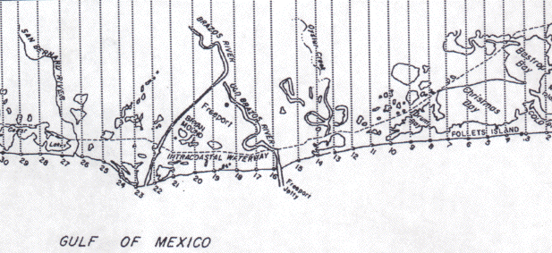
Locate the individual stations on the following map.